The contrast between the sandy coastal flats around Koombana Bay and the lateritic clay caps over the Tuart forest ridge creates very distinct resistivity signatures across Bunbury. We routinely see dry sands in the northern suburbs giving readings above 500 Ω·m while the estuarine clays near the Leschenault Inlet drop below 10 Ω·m — a spread that makes vertical electrical sounding a powerful tool for mapping lithological boundaries before any drilling starts. Our team uses the Schlumberger array with current electrode spacing up to 200 m AB/2 to resolve the limestone caprock that underlies much of central Bunbury, a unit that often masks deeper sand aquifers. Combining these readings with asentamiento diferencial analysis helps us distinguish between settlement-prone soft layers and competent bearing strata.
Resistivity surveys in Bunbury typically resolve a three-layer sequence: dry sand cap, saturated limestone, and soft estuarine clay — critical for foundation design.
Approach and scope
Site-specific factors
The Mediterranean-type climate of Bunbury, with wet winters and dry summers, creates a pronounced seasonal variation in soil resistivity. During the dry months from December to March, the surface layer can exceed 800 Ω·m, giving false confidence in shallow bearing capacity. Come July, after 600 mm of winter rain, the same profile drops below 50 Ω·m as the water table rises within 2 m of the surface. This contrast directly affects the interpretation of electrical resistivity surveys: a single dry-season sounding can overestimate the depth to competent strata. We always schedule surveys during the wetter months or apply moisture correction factors based on local Bureau of Meteorology rainfall data for the specific week of testing.
Regulatory framework
AS 1726:2017 Geotechnical site investigations, AS 1289 Standard test method for field measurement of soil resistivity, AS/NZS 3000:2018 (for earthing resistivity applications)
Related technical services
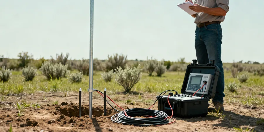
Vertical Electrical Sounding (VES)
Schlumberger array with up to 12 depth soundings per day, ideal for detecting the limestone caprock thickness and locating the sand-clay interface in residential subdivisions across Bunbury.
2D Resistivity Imaging
Multi-electrode profiles (48 electrodes, 5 m spacing) for mapping lateral variations along proposed road alignments or pipeline corridors, particularly effective in the estuarine zones near the Leschenault Inlet.
This service complements our laboratory testing work for a complete project analysis.
Typical parameters
Top questions
How deep can electrical resistivity / VES survey reach in Bunbury soils?
With current electrode spacing up to 200 m AB/2 using the Schlumberger array, we achieve investigation depths of approximately 30-40 m in Bunbury's dry sands and limestone. In saturated clays near the coast, the depth reduces to around 20-25 m due to lower resistivity contrast.
What is the typical cost range for an electrical resistivity survey in Bunbury?
For a standard VES survey with 6 soundings, the cost ranges between AU$1,020 and AU$1,690 depending on site access, electrode spacing, and the number of profile lines. 2D imaging with 48 electrodes runs higher due to increased equipment and processing time.
How does seasonal rainfall affect resistivity interpretation in Bunbury?
Winter rainfall can lower near-surface resistivity by a factor of 5-10 compared to summer dry conditions. We apply correction factors based on 28-day antecedent rainfall from the Bunbury BOM station and always note the soil moisture content at the time of testing in the report.