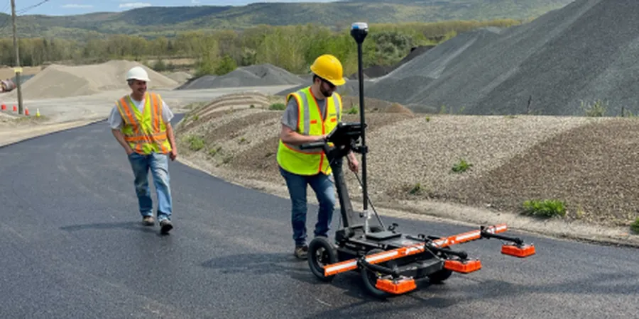
A common mistake we see from contractors in Bunbury is assuming all underground services are exactly where the as-built drawings say they are. The city's sandy coastal soils and variable fill layers near the Leschenault Estuary can shift or obscure old pipes, conduits, and voids. Relying solely on outdated plans often leads to unexpected hits during excavation, costing time and safety. A GPR (Ground Penetrating Radar) survey provides a non-invasive way to map what is actually below the surface before the first digger arrives. We combine this with a study of compaction through Proctor testing to verify fill density in suspect areas, and with field density checks using the sand cone method when backfill quality is uncertain. This layered approach reduces surprises in the field.
A GPR survey in Bunbury's coastal sands requires local knowledge of limestone and shell layers to avoid false positives in radar interpretation.
Approach and scope
- Plan-view maps of buried pipes, conduits, and tanks
- Depth slices showing changes in material at 0.25 m intervals
- Cross-section profiles for void and cavity identification
Site-specific factors
A hospital extension near the Bunbury CBD required excavation within 1.5 m of an existing 11 kV feeder. The contractor had no as-built records for a 1960s stormwater line suspected to cross the site. A quick GPR survey identified the line at 1.1 m depth, plus an undocumented gas service running obliquely. Without that data, the excavator would have hit both, causing a shutdown and a gas leak. The cost of the survey was less than one hour of lost time on a project running over AU$2 million. In Bunbury, where older infrastructure maps are often incomplete, a GPR survey is a low-cost insurance policy against costly strikes.
Regulatory framework
AS 1726-2017 Geotechnical Site Investigations, AS 4678-2002 Earth Retaining Structures, AS/NZS 1170.0-2002 Structural Design Actions (general principles)
Related technical services
Utility Mapping for Excavation
Pre-dig detection of water mains, gas lines, electrical conduits, and telecom cables. Delivered as a geo-referenced CAD plan with depth tags. Ideal for subdivisions and road works.
Rebar and Void Detection in Concrete
Locate reinforcement, post-tension cables, and voids in slabs, walls, and bridge decks. Uses 1.6 GHz antenna for high-resolution scans. Common for parking structures and industrial floors.
Subsurface Cavity and Grave Detection
Identify voids, sinkholes, or unmarked graves in sandy soils. Often requested for historical sites near the Bunbury port or for sinkhole risk assessments on residential lots.
This service complements our laboratory testing work for a complete project analysis.
Typical parameters
Top questions
How deep can a GPR survey reach in Bunbury's sandy soils?
In clean dry sand typical of the Bunbury coastal plain, we achieve depths of 3-4 m with a 200 MHz antenna. Depth reduces to 1.5-2 m in wet clay or saline conditions near the estuary. We always test a small area first to confirm signal penetration before committing to a full grid.
What is the cost range for a GPR survey in Bunbury?
For a typical residential block (around 600 m² grid), the survey cost ranges from AU$1,660 to AU$3,130 depending on grid density and whether you need CAD deliverables versus a simple report. Large commercial sites with complex utility mapping can run higher.
Can GPR detect plastic pipes and fibre optic cables?
Yes, but with limitations. Plastic pipes and fibre cables are visible only if there is a dielectric contrast with the surrounding soil. In dry sand they show clearly; in wet clay they are harder to distinguish. We often combine GPR with a radio-frequency utility locator for non-metallic targets.
Do you need to close the site while the GPR survey is running?
No. GPR is completely non-destructive and requires only walking access. We can scan active construction sites, operating car parks, or hospital grounds without interrupting work. The only requirement is that the surface is reasonably smooth and free of thick vegetation.